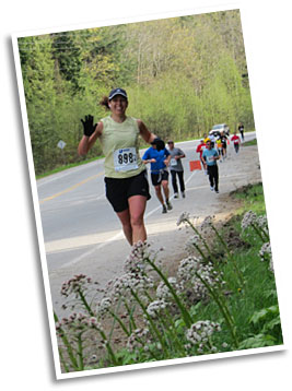
Event Info » Course map and description » Course Tour
Course Photo Tour
Also see: Course Fly-Over Video by Keith Dunn
- Start on Park Road
- Right after the start, on Park Road
- Top of Park Road
- Along Reed Road
- Turning onto Payne Road
- Heading down Payne Road
- Payne near Gibsons Park Plaza
- Top of Pratt Road
- Pratt Road
- Pratt at Chaster, 3km
- Bottom of Chaster
- Further along Chaster
- King Road, 4 km
- Veterans Road, 5 km
- Nearing Lower Rd, 7 km
- Top of Lower Road
- Heading down Lower Road
- Midway down hill, 8 km
- Small uphill on Lower Road, 9 km
- Camp Byng, Lower Road
- Just before halfway, on Lower Road
- Flat section on Lower Road
- Gentle downhill, Lower Road
- Roberts Creek
- Roberts Creek Village
- Roberts Creek Road
- Beach Avenue
- Beach Avenue part 2
- Beach Avenue part 3, 14 km
- Beach Avenue part 4
- Reaching Marlene Rd.
- Foot of Marlene Rd
- Top of Marlene Rd., 15 km
- Hwy in Roberts Creek
- Top of Rat Portage Hill, 17 km
- Bottom of Hill
- Wilson Creek, 20 km
- Chapman Creek Bridge
- Entering Mission Point Park
- Finish Line